Directionality Analysis
Understanding how people move through parks and trail systems.
Waypoint systems determine the direction of travel for detected subjects, allowing land managers to analyze entry and exit patterns at trailheads, access points, and park infrastructure.
By identifying whether users are entering or departing a location, the system enables new types of recreation analytics that are not possible with traditional counters.
Why Direction Matters
Traditional trail counters only measure total traffic.
They cannot determine whether visitors are entering or leaving a park, trail system, or access point.
Waypoint directionality detection makes it possible to measure:
- •Inbound vs outbound traffic
- •Flow patterns through trail networks
- •Peak entry times
- •Parking demand patterns
- •Visitor movement through multi-access parks
This information provides a deeper understanding of how recreation infrastructure is actually used.
A Model Trained Specifically for Trails
Directional detection in outdoor environments is difficult.
Trail cameras capture highly variable imagery including:
- •Changing lighting conditions
- •Partial occlusions
- •Off-angle subjects
- •People stopping or turning around
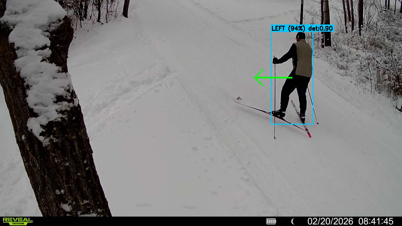
- •Mixed recreation modes (walkers, bikers, skiers)
Generic computer vision models perform poorly in these conditions.
Waypoint developed a custom direction classification model trained on thousands of annotated trail camera images from real deployments.
This training dataset includes multiple recreation modes and environmental conditions to ensure robust performance in outdoor settings.
The result is a model specifically optimized for trail monitoring rather than general-purpose object tracking.
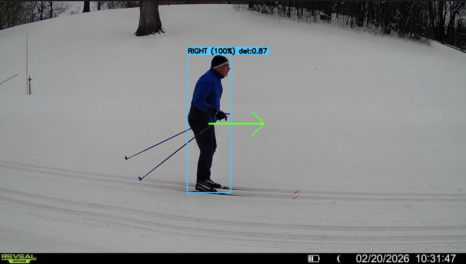
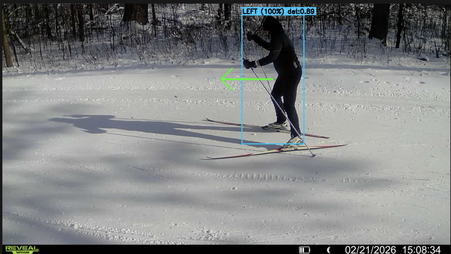
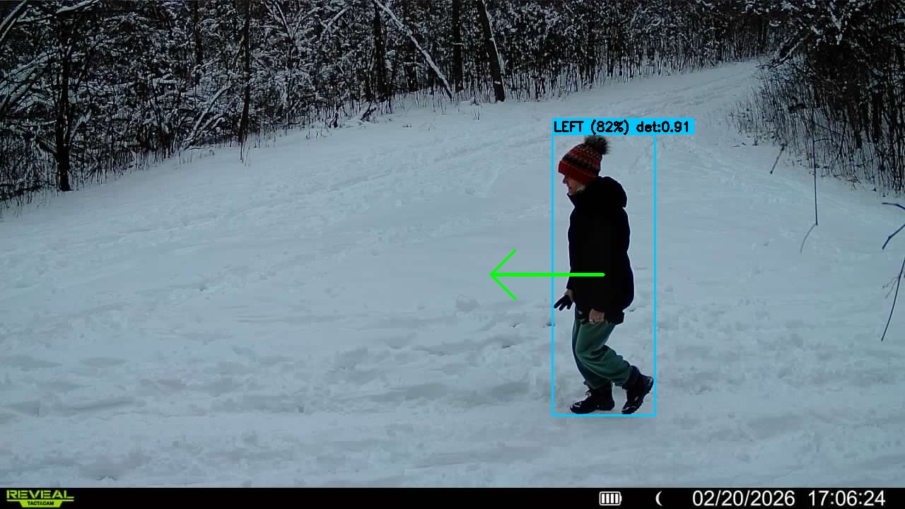
Two-Stage Direction Classification
Waypoint uses a two-stage detection process to determine direction.
Stage 1 — Object Detection
The system first detects subjects using the primary vision model.
Objects such as people, bikes, and vehicles are identified within the image frame.
Stage 2 — Direction Classification
Detected subjects are passed to a dedicated direction classifier that determines one of three states:
- •Left (moving across the frame in the left direction)
- •Right (moving across the frame in the right direction)
- •Unknown (insufficient movement evidence)
This simplified classification model allows extremely high reliability in typical trail environments.
Temporal Tracking Across Frames
To increase reliability, the system analyzes subject movement across multiple frames.
Rather than assigning direction based on a single image, the model observes how detected subjects move across the camera field of view.
This temporal analysis allows the system to distinguish true movement from:
- •Stationary subjects
- •Momentary occlusions
- •Partial frame detections
Multi-frame tracking significantly improves directional accuracy.
Directional Flow Analytics
Once directional detections are generated, they are aggregated in the Waypoint analytics platform.
Land managers can analyze:
- •Inbound vs outbound traffic
- •Directional flow over time
- •Directional activity by recreation type
- •Directional patterns across multiple cameras
These insights help planners understand how visitors move through recreation infrastructure.
Applications for Park Management
Directional data enables several practical analyses.
Trail Entry / Exit Analysis
Measure how many visitors enter or leave a trail system at specific access points.
Trailhead Demand
Understand when people arrive at and depart from trailheads.
Parking Demand Estimation
Directional vehicle counts can estimate parking occupancy patterns.
Origin-Destination Studies
Multi-camera deployments allow planners to study how users move through trail networks.
Peak Flow Monitoring
Identify periods when most visitors are entering or leaving park infrastructure.
Model Validation
Waypoint direction models have been validated through controlled field deployments and manual annotation studies.
Validation methods include:
- •Comparison with manual direction counts
- •Human-annotated video ground truth
- •Multi-site field testing
These studies demonstrate that the direction classifier performs reliably in real-world trail environments.