Technology Overview
Waypoint Telemetry is an end-to-end sensing platform designed to measure how people use outdoor recreation infrastructure. Using autonomous solar cameras and advanced computer vision models, the system converts real-world activity on trails, parks, and access points into accurate, real-time telemetry data for planners and land managers.
How the System Works
Waypoint combines autonomous field sensors, computer vision models, and cloud analytics into a unified telemetry system. The platform transforms raw outdoor activity into structured datasets that support recreation planning, infrastructure investment, and environmental stewardship.
Solar Camera Hardware
Autonomous cellular cameras powered by solar panels and battery banks, deployed in remote outdoor locations without grid infrastructure.
Edge Image Capture
High-resolution images captured on motion detection or scheduled intervals, optimized for AI processing while preserving privacy.
AI Detection Pipeline
Computer vision models detect and classify recreational activities including hikers, bikers, skiers, vehicles, and watercraft with high accuracy. Learn more about high accuracy detection.
Subject Tracking
Multi-frame tracking algorithms suppress duplicate detections and ensure accurate count data across camera view transitions. See our subject noise filtering validation.
Directionality Model
Specialized algorithms determine travel direction and flow patterns, enabling trail entry/exit analysis and origin-destination studies. Learn more about directionality modeling.
Telemetry Dashboard
Real-time data visualization and analytics platform providing activity trends, usage patterns, and operational insights.
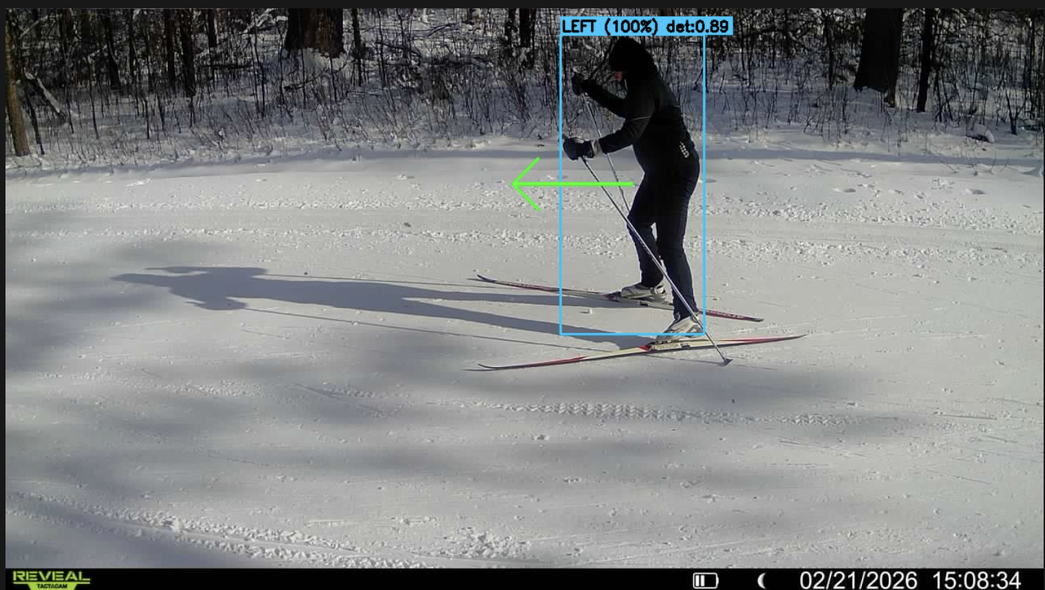
Directionality detection in action - AI model tracking a cross-country skier with directional flow classification
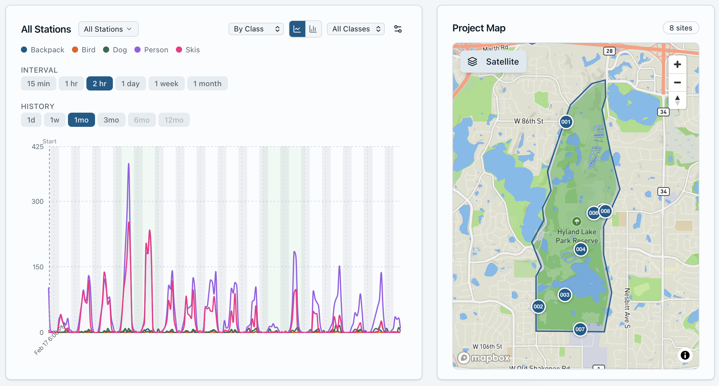
Real-time telemetry dashboard with activity analytics and geographic distribution of monitoring stations
From Raw Data to Recreation Intelligence
Waypoint's value extends beyond simple activity counts. The platform transforms raw field observations into structured recreation intelligence through a multi-stage data enrichment pipeline, with each deployment contributing to improved detection models and analytical capabilities.
Field Observations
Raw camera images from diverse trail environments, lighting conditions, and activity types create a rich observational dataset.
Activity Telemetry
Computer vision models extract structured activity data including counts, classifications, directionality, and temporal patterns.
Recreation Intelligence
Aggregated insights reveal usage patterns, seasonal trends, infrastructure stress points, and planning-grade analytics.
Continuous Improvement
Each field deployment generates training data that improves detection accuracy across new environments. This creates a compounding advantage where system performance strengthens with scale and deployment diversity.
Core Platform Capabilities
High Detection Accuracy
Waypoint's detection models identify recreational users with high accuracy across varied lighting, weather, and seasonal conditions.
Multimodal Classification
Simultaneous detection and classification of multiple activity types including hikers, bikers, skiers, and vehicles.
Directional Flow Analysis
Accurate determination of travel direction enabling sophisticated trail traffic and flow pattern analysis.
Autonomous Operation
Solar-powered systems operate continuously for months without maintenance in remote locations.
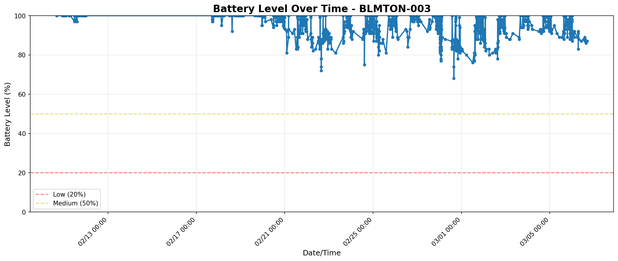
Real battery performance from a 2-week winter deployment showing sustained autonomous operation
Privacy-Preserving Design
Image processing pipeline anonymizes individuals while preserving activity detection capabilities.
Cellular Connectivity
Remote data transmission via cellular networks enables real-time monitoring from any deployment location.
Designed for Outdoor Environments
Outdoor recreation monitoring presents unique challenges including variable lighting, weather, seasonal vegetation changes, and complex user behavior. Waypoint's sensing platform is designed specifically for these environments, combining rugged field hardware with AI models trained on real outdoor recreation data.
- • Robust performance across changing lighting and weather conditions
- • Accurate detection of multiple recreation types in shared trail environments
- • Low-power autonomous operation for remote deployments
- • Privacy-conscious design for public land monitoring
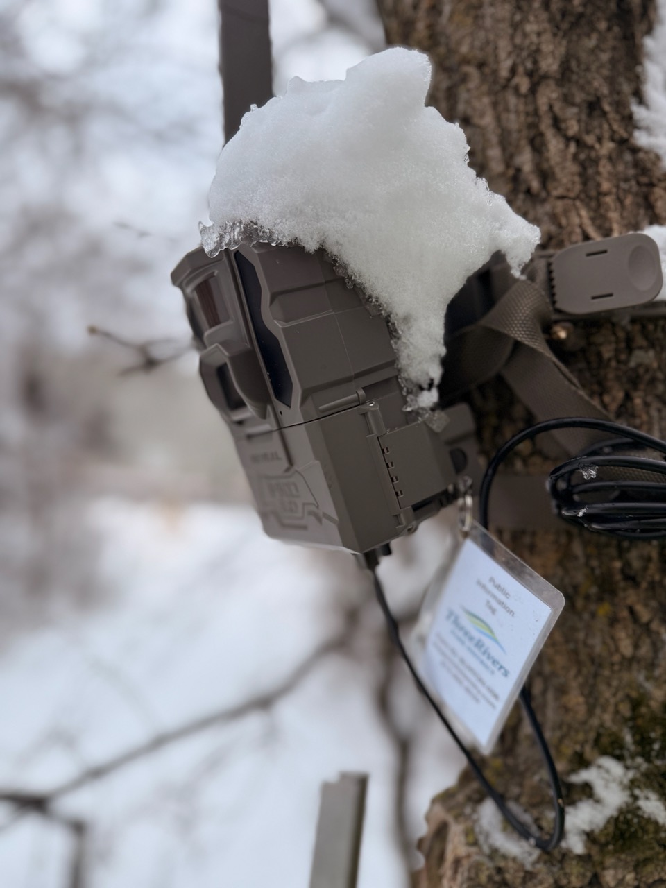
Waypoint camera operating autonomously in harsh winter conditions - demonstrating rugged reliability in remote environments
Why Vision-Based Telemetry Matters
Beyond Traditional IR Counters
Traditional infrared counters measure only simple beam breaks. Waypoint's vision-based system observes the full scene, enabling activity classification, directionality detection, and more reliable counts in complex real-world conditions.
Advanced Noise Filtering
Proprietary subject tracking algorithms eliminate duplicate counts and false positives, significantly improving data accuracy over simple frame-by-frame detection.
Zero Infrastructure Requirements
Complete autonomous operation via solar power and cellular connectivity enables deployment in remote wilderness areas without electrical or network infrastructure.
Applications
Recreation Infrastructure Management
Monitor visitor usage patterns, identify peak periods, and optimize resource allocation.
Transportation Planning
Quantify active transportation usage on trails and greenways for infrastructure planning.
Environmental Research
Study human-wildlife interactions and recreational impact on sensitive ecosystems.
Economic Analysis
Quantify outdoor recreation usage for tourism impact and economic development studies.
Related Resources
Vision vs IR Trail Counters
Research-backed comparison of infrared counter accuracy versus camera-based systems.
Read comparison →Subject Noise Filtering
How Waypoint eliminates duplicate counts through advanced tracking algorithms.
View validation →Hyland Lake Deployment
See the technology in action at a regional park reserve pilot study.
View deployment →