Nine Mile Creek Pedestrian Bridge Study
A pedestrian-use study of the Nine Mile Creek pedestrian bridge over Highway 100 in Edina, Minnesota, measuring multi-use crossing volumes, helmet-use compliance, entrance traffic, and peak usage times — conducted in partnership with the Minnesota Department of Transportation (MnDOT).
Deployment Overview
Deployment Parameters
Study Objectives
- •Measure multi-use crossing volumes — pedestrians, cyclists, and other trail users
- •Track helmet-use compliance among cyclists
- •Quantify entrance and access-point traffic to the bridge
- •Identify peak crossing times by day and hour
- •Demonstrate infrastructure-free monitoring on a transportation asset
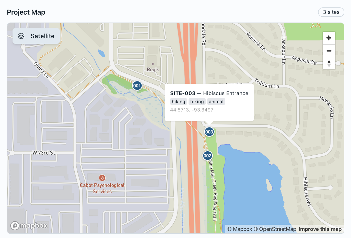
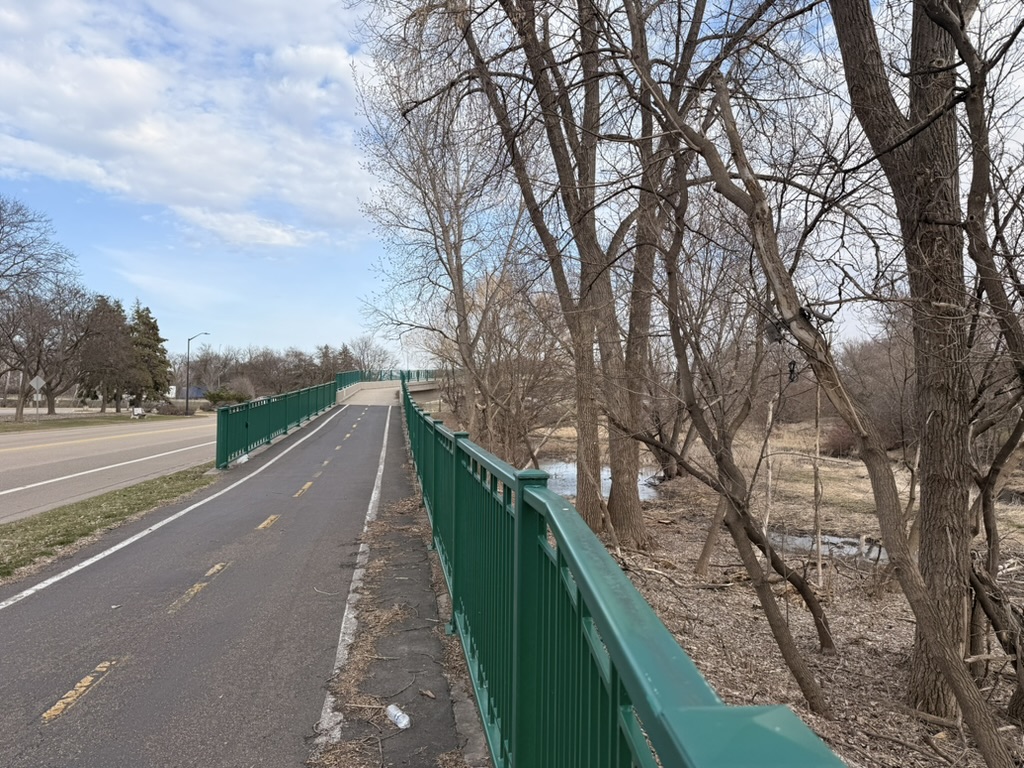
Site Description
The Nine Mile Creek pedestrian bridge carries a regional trail over Highway 100 in Edina, separating non-motorized users from high-speed traffic. Because the bridge funnels pedestrians, cyclists, and other trail users into a single span, it is an ideal vantage point to measure multi-use volumes, helmet-use compliance, entrance traffic, and peak crossing times — data that helps MnDOT understand how the crossing is used and plan for non-motorized travel.
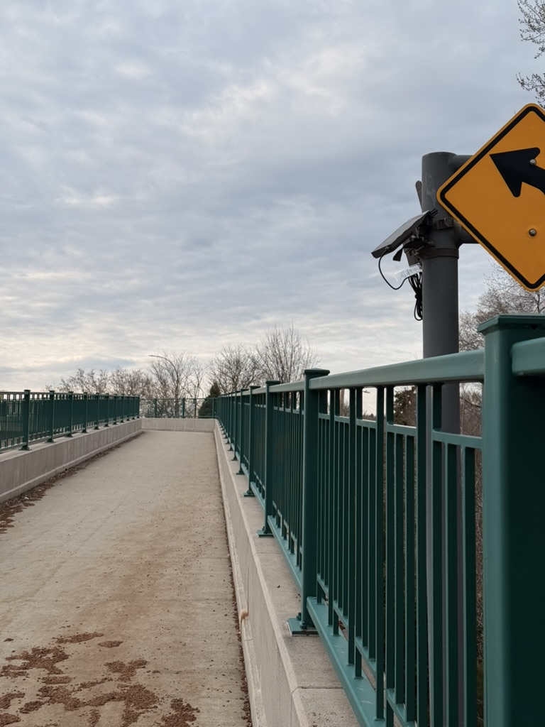
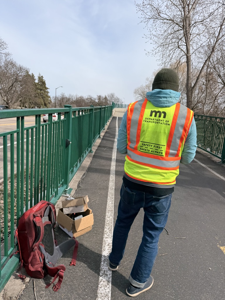
Camera Placement in the Field
Solar-powered Waypoint stations were mounted on existing bridge infrastructure — no trenching, grid power, or permanent hardware required.
Deployment Results
Key Findings
Overwhelmingly a non-motorized crossing
1,501 of 1,584 detections (95%) were people, confirming the bridge functions almost entirely as a pedestrian and cyclist crossing.
2,105 crossings counted
Across the study window the system tallied 2,105 multi-use crossings, giving MnDOT a concrete volume figure for a previously unmeasured asset.
Helmet-use compliance from imagery
Because detections are image-based, helmet-use compliance is assessed directly from the same feed — no separate field survey required.
True multi-use breakdown
Across the 4-day study the system distinguished walkers, kids, strollers, dog walkers, and cyclists — even mopeds and e-bikes — in a single pass, turning a raw count into an actionable multi-use profile.
System Performance
The deployment ran at 100% uptime across the study. One of the three sites underperformed on detections due to a visual obstruction in its field of view — a reminder that camera placement is decisive for clean results.
Key Learnings from the Study
Every field deployment yields engineering and methodological insights. The following observations emerged from the Nine Mile Creek study and will inform future instrumentation and analytical approaches.
1. Multi-use detection is feasible and insightful
Capturing and classifying the full mix of bridge users — rather than a single undifferentiated count — produced genuinely useful planning data.
2. Helmet detection is feasible and accurate
Helmet-use compliance can be assessed directly and reliably from the imagery, with no separate field survey required.
3. Site location and technique are critical
Detection quality depends heavily on where and how each station is mounted — careful site selection and deployment technique are key to clean results, as one obstructed site demonstrated.
Next Steps & Areas of Interest
The natural next step is a comparative validation study — benchmarking Waypoint's detection accuracy against manual counts and alternative counting providers at the same site.
Thank You
We appreciate the Minnesota Department of Transportation's willingness to participate in this study and engage with the findings. This work was designed in the spirit of open inquiry—testing whether vision-based monitoring can meaningfully contribute to the toolset available to transportation and planning professionals.