Multi-Modal Activity Detection
Understanding how people use outdoor infrastructure.
Waypoint VisionAI systems analyze imagery from monitoring stations to detect and classify different types of recreation activity.
Rather than simply counting beam interruptions like traditional trail counters, the system observes the visual scene and identifies the types of activity taking place.
This allows land managers to measure how trails, parks, and access points are actually used.
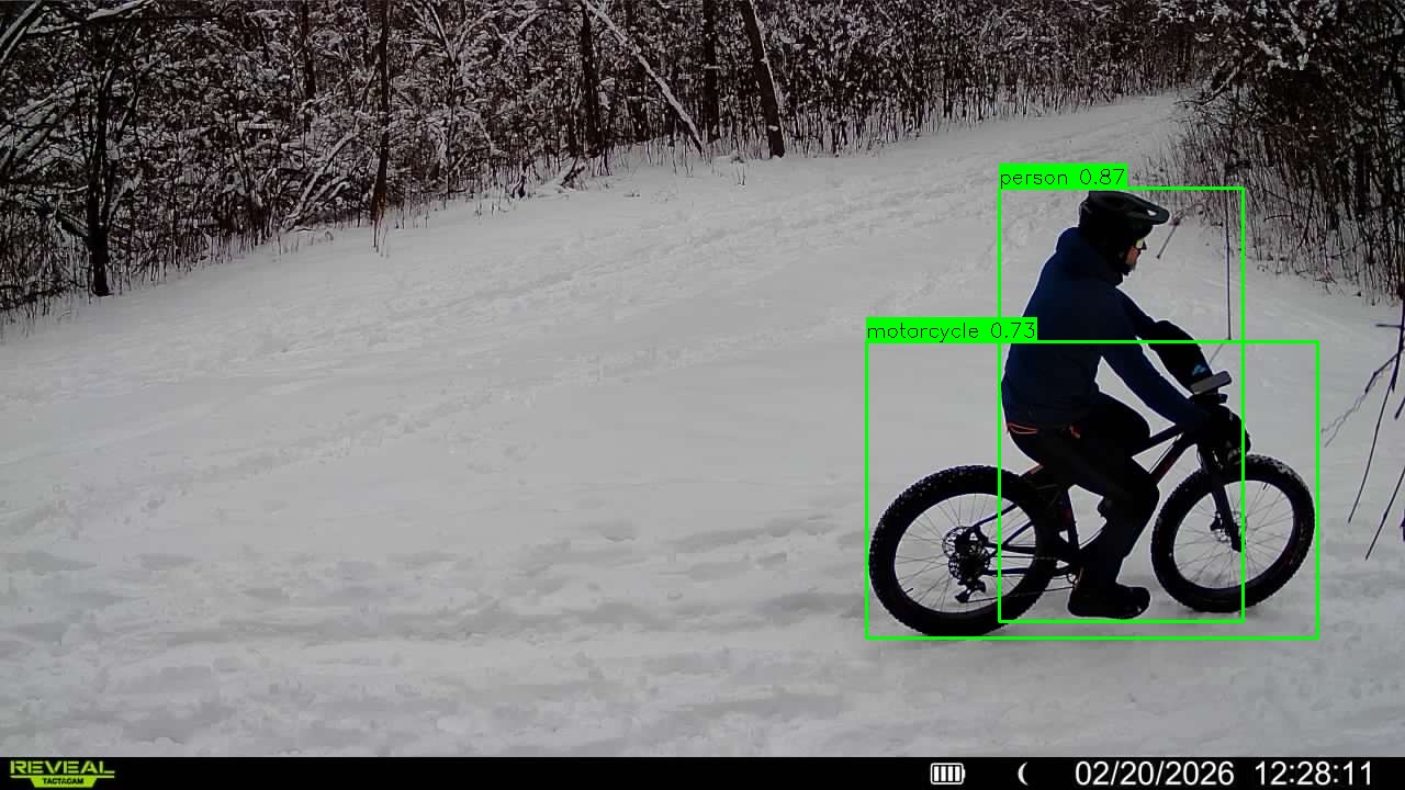
Vision-based detection identifying both cyclist and bicycle on a winter trail
Beyond Simple Visitor Counts
Most recreation monitoring systems measure only a single metric: total traffic.
Infrared counters cannot distinguish between different recreation modes. A hiker, cyclist, dog, or wildlife crossing the beam all appear as identical counts.
Waypoint VisionAI directly analyzes images to identify what type of activity is occurring.
This enables recreation telemetry that reflects how people are actually using infrastructure.
Examples include distinguishing between:
- • hikers
- • cyclists
- • dog walkers
- • vehicles
- • watercraft users
Vision-Based Activity Classification
Waypoint uses computer vision models trained on outdoor recreation imagery.
The system detects objects within the image and classifies them into activity categories.
These models are trained on thousands of trail camera images collected from real-world recreation environments.
Because the system analyzes visual features rather than simple motion triggers, it can distinguish between different activity types that would otherwise appear identical to traditional counters.
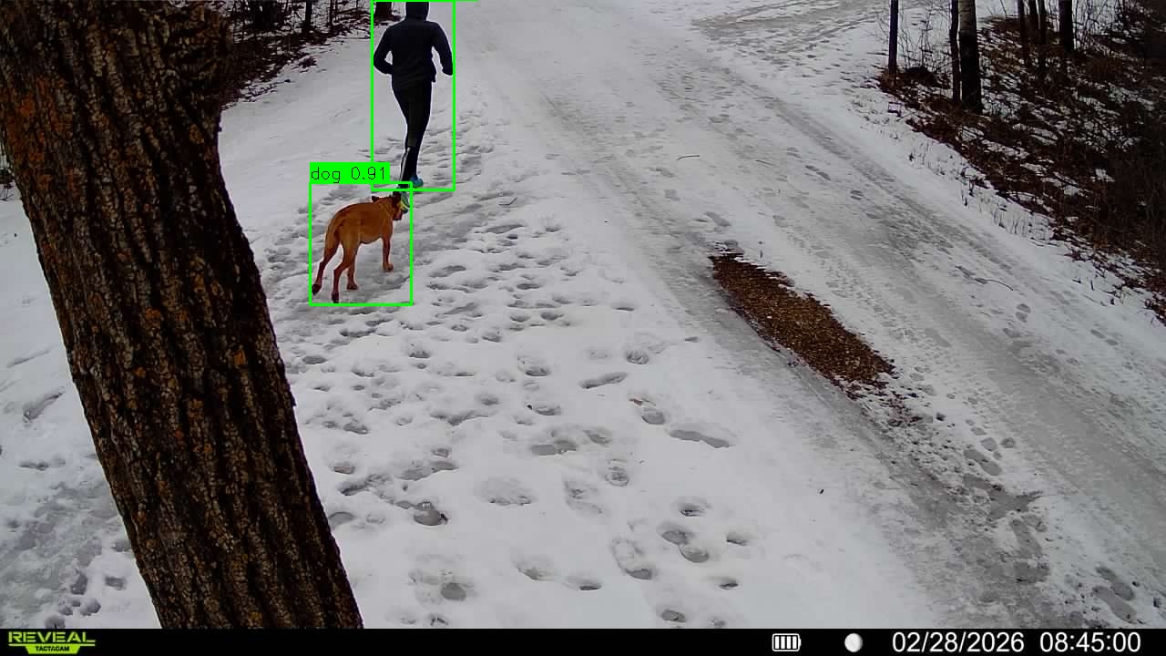
Bounding box detection of runner and dog on trail
Examples of Detected Activity Types
Waypoint VisionAI models can identify a variety of recreation modes depending on deployment location.
Common activity classes include:
Human Activities
- • walking / hiking
- • dog walking
- • running
- • cycling
- • cross-country skiing
Vehicles
- • cars
- • trucks
- • park service vehicles
Water Access Points
- • boats
- • kayaks
- • canoes
Wildlife and Non-Human Activity
- • animals
- • environmental motion events
The ability to separate these categories allows the system to produce detailed activity breakdowns for each monitoring site.
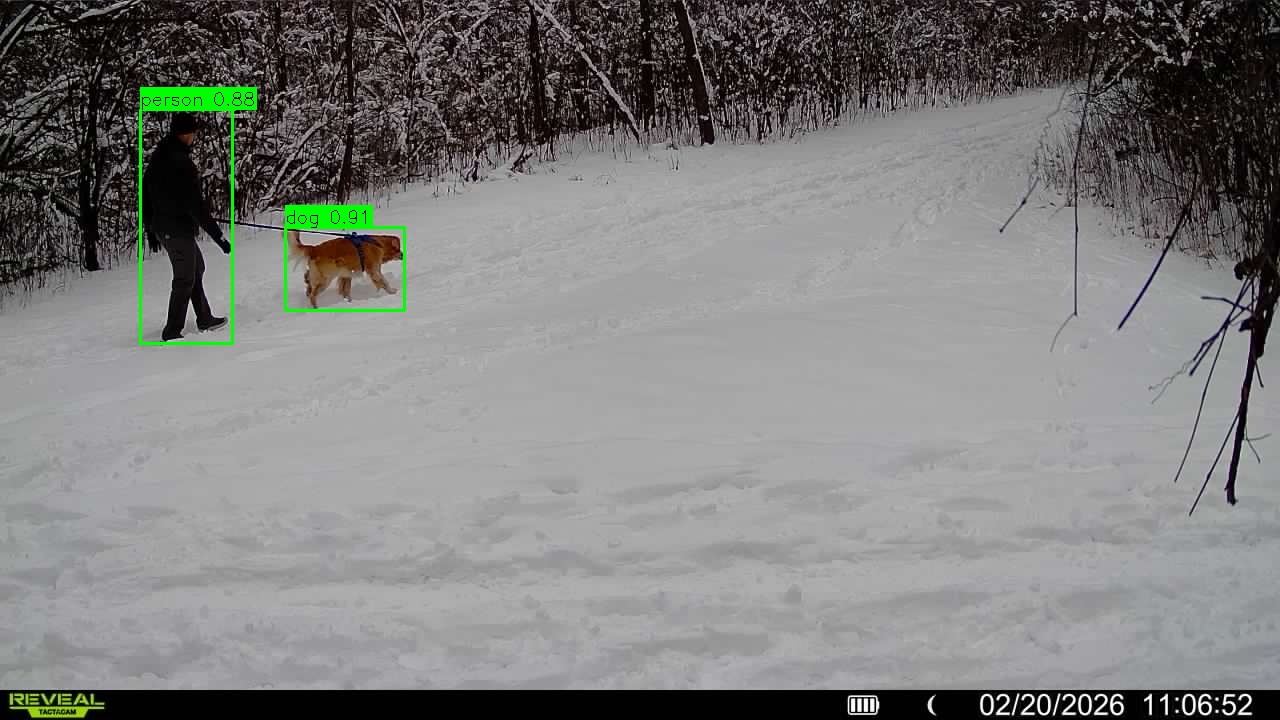
Dog walking activity - person and dog classified separately
Cycling activity
Running activity
Multi-Modal Recreation Analytics
Because activity types are classified individually, the Waypoint platform can analyze recreation patterns across different modes.
Examples include:
- • comparing hikers vs cyclists on shared-use trails
- • measuring seasonal shifts from hiking to skiing
- • tracking dog walking activity in urban parks
- • understanding vehicle traffic at trailheads
- • monitoring boat launch usage
These insights help agencies understand how infrastructure supports different recreation communities.
Flexible Across Monitoring Environments
Waypoint VisionAI systems can operate across many different recreation settings.
Examples include:
Trail Systems
Monitoring hikers, runners, cyclists, and dog walkers.
Winter Recreation
Distinguishing cross-country skiing activity from pedestrian use.
Trailheads and Access Roads
Detecting vehicles entering and exiting parking areas.
Water Access Points
Counting boats, kayaks, and canoes launching from access points.
Because activity classification is handled by the vision models, the same hardware platform can support these different environments.
No firmware changes or specialized sensors are required.
One Platform, Many Use Cases
Traditional monitoring infrastructure is typically designed for a single measurement type.
Waypoint systems provide a flexible monitoring platform that can support many recreation analytics use cases using the same camera hardware.
By updating the computer vision models and analytics software, the system can adapt to different monitoring objectives without replacing field equipment.
This flexibility allows agencies to deploy monitoring networks that evolve with changing research and planning needs.