
01 · The challenge
A total count is where most trail data stops
Since 2013, MnDOT’s Pedestrian and Bicyclist Data Program has built a network of permanent counters and portable counters that can be borrowed, to inform state, regional and local planning.[6] Through its counter loaner program, cities and organizations without their own equipment can measure a trail or a street.
An infrared counter does one thing well: it counts bodies passing a beam. It can’t say whether they were walking, riding or pushing a stroller, whether a cyclist wore a helmet, or whether a motorbike was on a path built for people. Waypoint approached MnDOT to find out whether a vision-based counter could match the infrared count and add that context.
02 · Background
The only crossing of Highway 100 for about a mile
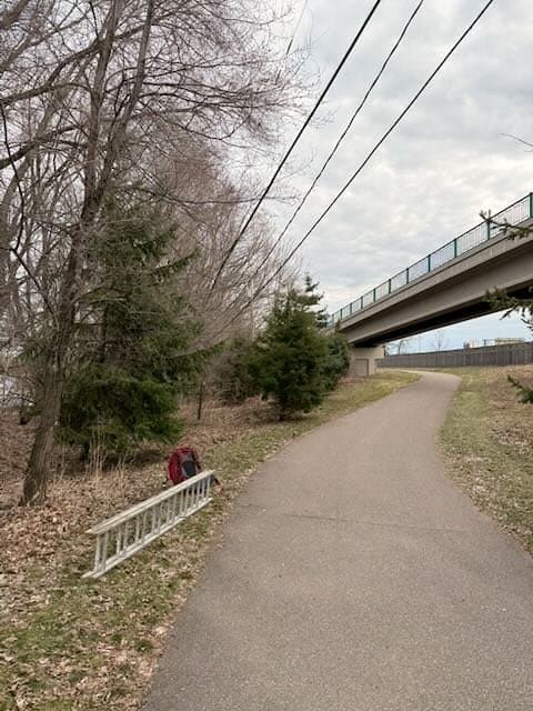
The Nine Mile Creek Regional Trail is a 15.3-mile paved trail through Hopkins, Minnetonka, Edina and Richfield, run by Three Rivers Park District.[2] In Edina it crosses state highways on two long concrete girder pedestrian bridges, 588 and 1,025 feet long.[4][1] The Highway 100 bridge is the only way to cross the highway on foot or by bike within about a square mile, so every trip across it passes one point: an ideal spot to compare counters.
2000 – 2014
The first 9.2 miles were built through Hopkins, Minnetonka, Richfield and Bloomington, leaving a gap through Edina.[4]
2013
MnDOT started the Minnesota Pedestrian and Bicyclist Data Program.[6]
2014
Three Rivers applied for federal funds for the west Edina segment and projected more than 500,000 visitors a year for the whole trail.[5]
June 3, 2018
The completed trail opened. The Edina segment took nearly four years and $25 million, with two highway bridges and 1.7 miles of timber boardwalk.[3][4] MnDOT, the Metropolitan Council, Hennepin County and four cities were partners.[3]
April 2026
Waypoint and MnDOT ran AI trail cameras beside a loaned infrared counter on the Highway 100 bridge.
03 · The approach
One infrared counter, three cameras
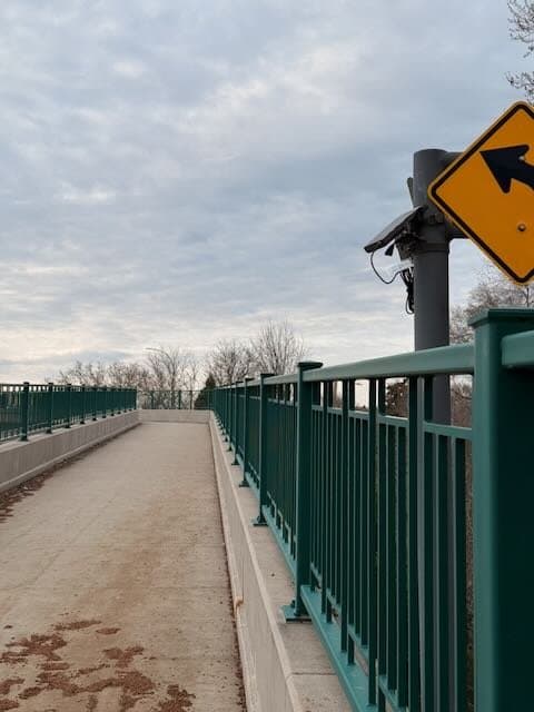
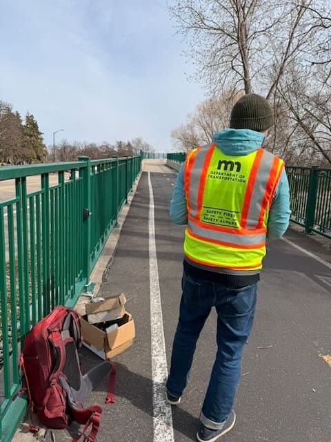
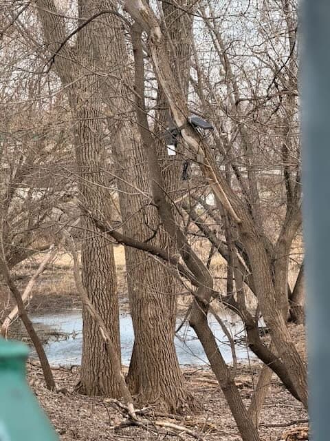
MnDOT staff and Waypoint installed the equipment together in early April. An Eco-Counter PYRO-Box infrared counter from MnDOT’s loaner fleet went at the west entrance to the bridge, and three solar cellular cameras went around it:
- Site 1, the west entrance, beside the infrared counter. Trees and poles were scarce, so the camera looked through the bridge fence with highway traffic behind it.
- Site 2, on the bridge, about 200 feet along with no exits in between, added as the reliable reference.
- Site 3, the Hibiscus entrance, in a tree over a feeder path from the neighborhood east of Highway 100.
Nothing was drilled, wired or trenched. Every passage is classified by activity and direction of travel, cyclists are checked for helmets, faces are blurred automatically, and each count links to the photo behind it.
04 · Against the IR counter
Hour by hour, the camera tracked the infrared counter closely
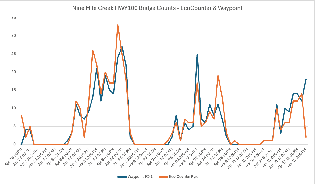
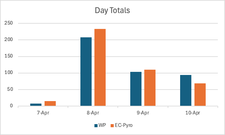
Comparing the bridge camera (Site 2) with the infrared counter hour by hour showed strong correlation: the same morning rise, the same afternoon peaks, the same quiet nights. On the two full test days the infrared counter’s totals were 12% and 6.8% higher than the camera’s.
Which one is closer to the truth is still open. Infrared counters are known to both overcount and undercount, and spring weather cut the planned manual counts short, so there was no full manual count to settle it. In a 90-minute manual check, the bridge camera made no errors.
Two cameras 200 feet apart showed how much placement matters
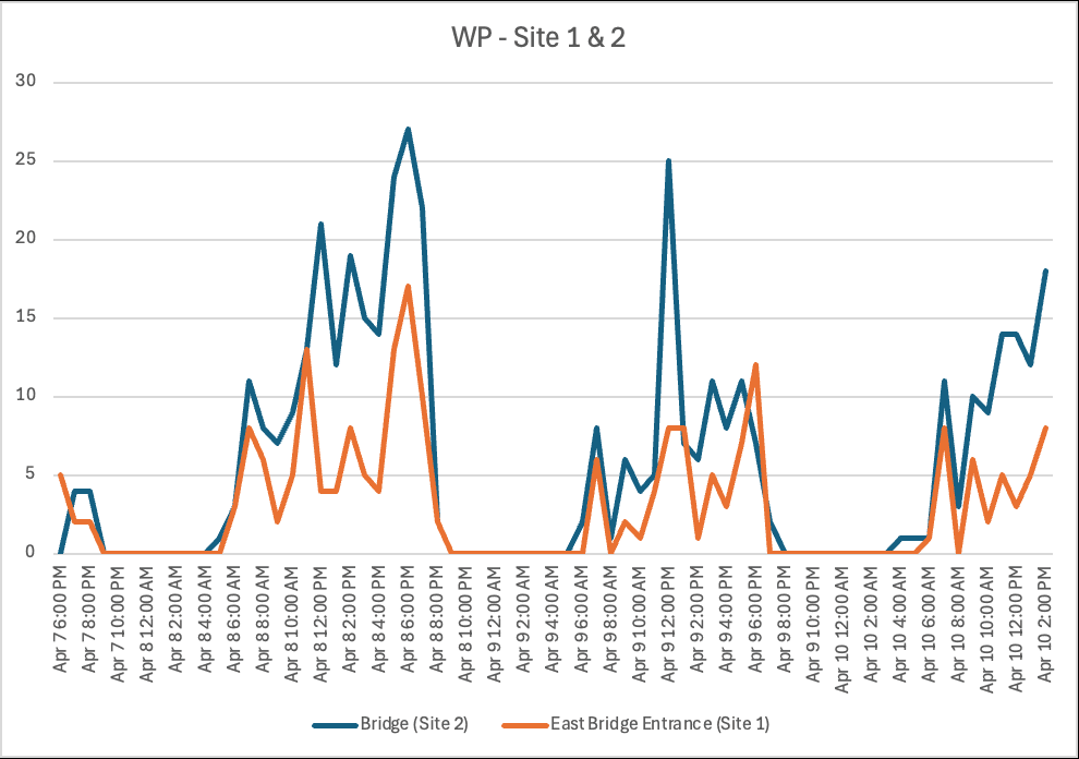
Sites 1 and 2 are on the same stretch of trail with no exits between them, so they should count the same people. They didn’t: Site 1 missed about 47% of the detections Site 2 made over three days.
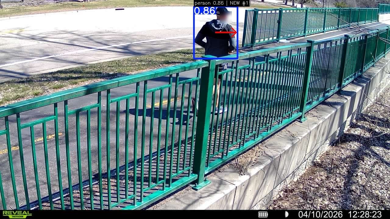
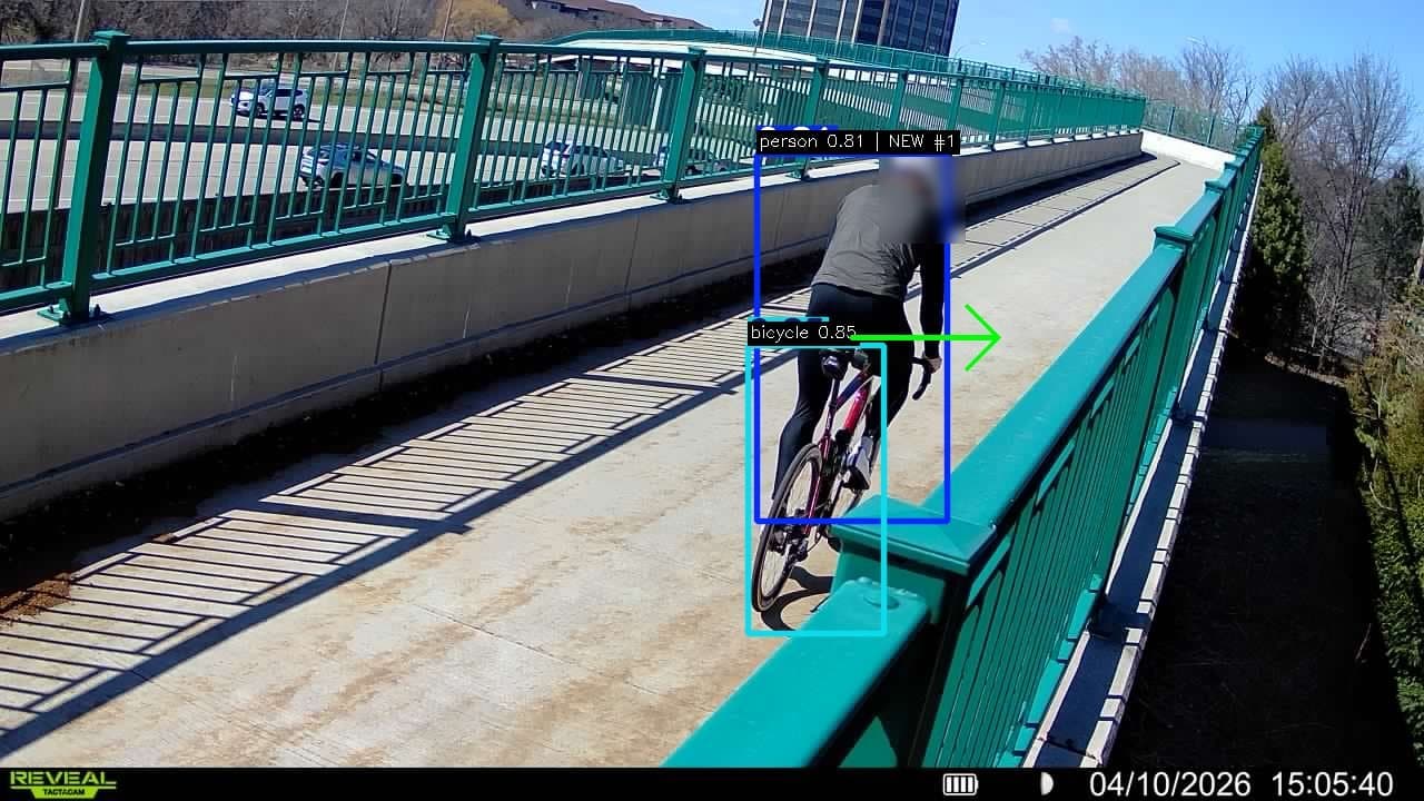
The cause was the site, not the model. Site 1 looked through the bridge fence, which hid people and confused motion detection, and passing highway traffic kept triggering the camera. Each trigger starts a 10-second cool-down, and people who passed during it were missed. The people it did capture were classified correctly, with the right direction. See how detection holds up in hard conditions.
05 · What the counter can’t see
Who uses the bridge, and who doesn’t
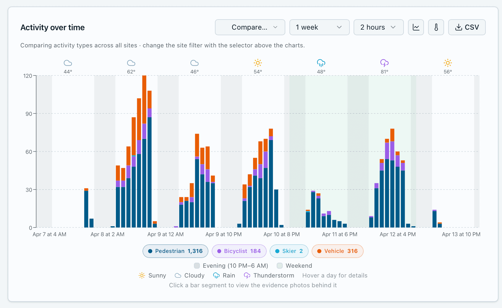
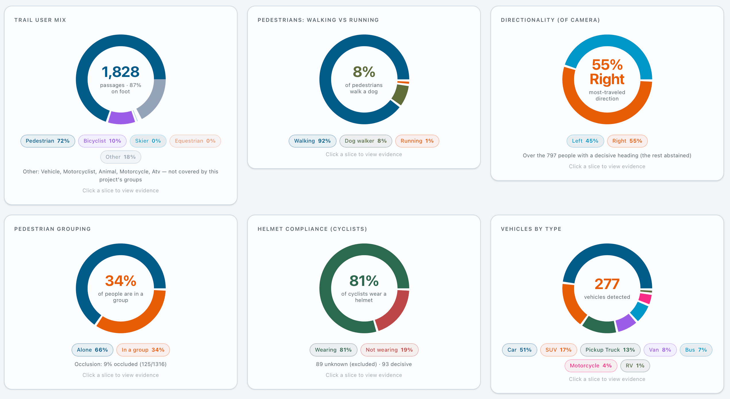
Over the week the three cameras counted 1,828 passages. Of the people, 87% were on foot and most of the rest rode bikes. Among pedestrians, 92% were walking, 8% walking a dog and about 1% running, and 34% of people came in a group. The busiest day was a mild, cloudy Wednesday, April 8, and the busiest weekend day was a warm, stormy Sunday, April 12.
The “vehicle and other” share is mostly cars, trucks and buses on Highway 100, seen through the bridge railing. An exclusion drawn over the highway lanes keeps that traffic out of the trail counts.
- Pedestrian
- 72%
- 1,316
- Bicyclist
- 10%
- 184
- Vehicle & other
- 18%
- 328
81%
of cyclists wore a helmet, of 93 where it could be seen
87%
of people were on foot
34%
of people were in a group
55 / 45
split in direction of travel, of 797 people with a clear heading
Dog walkers turn back before the bridge
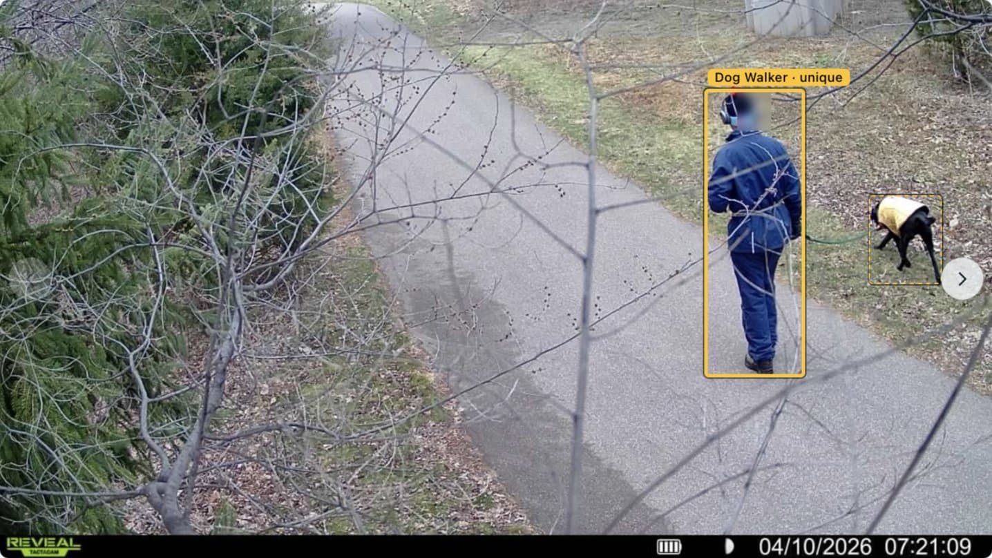
We noticed it on site first: plenty of dogs on the Hibiscus entrance path, few on the bridge. The data confirmed it. Of 98 dog walkers counted, 80 were at the Hibiscus entrance and only 18 on the bridge.
People walking dogs use the trail near home and mostly don’t cross the highway. An infrared counter on the bridge would never show that. The same counts show how much traffic this low-profile entrance carries as a gateway for the Edina neighborhood east of Highway 100.
- Hibiscus entrance80
- Bridge, east end10
- Bridge, west end8
Motorbikes on a non-motorized bridge
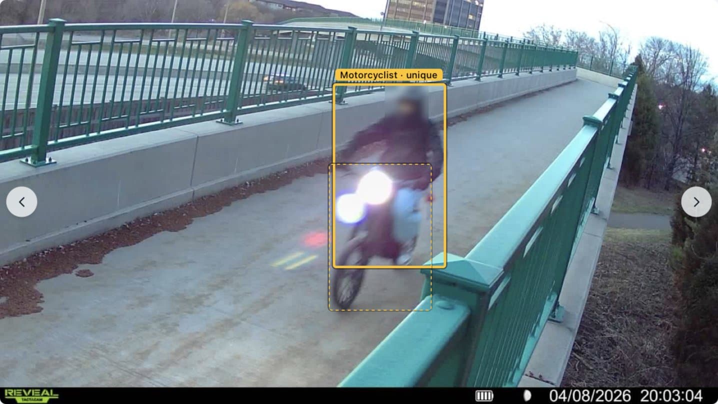
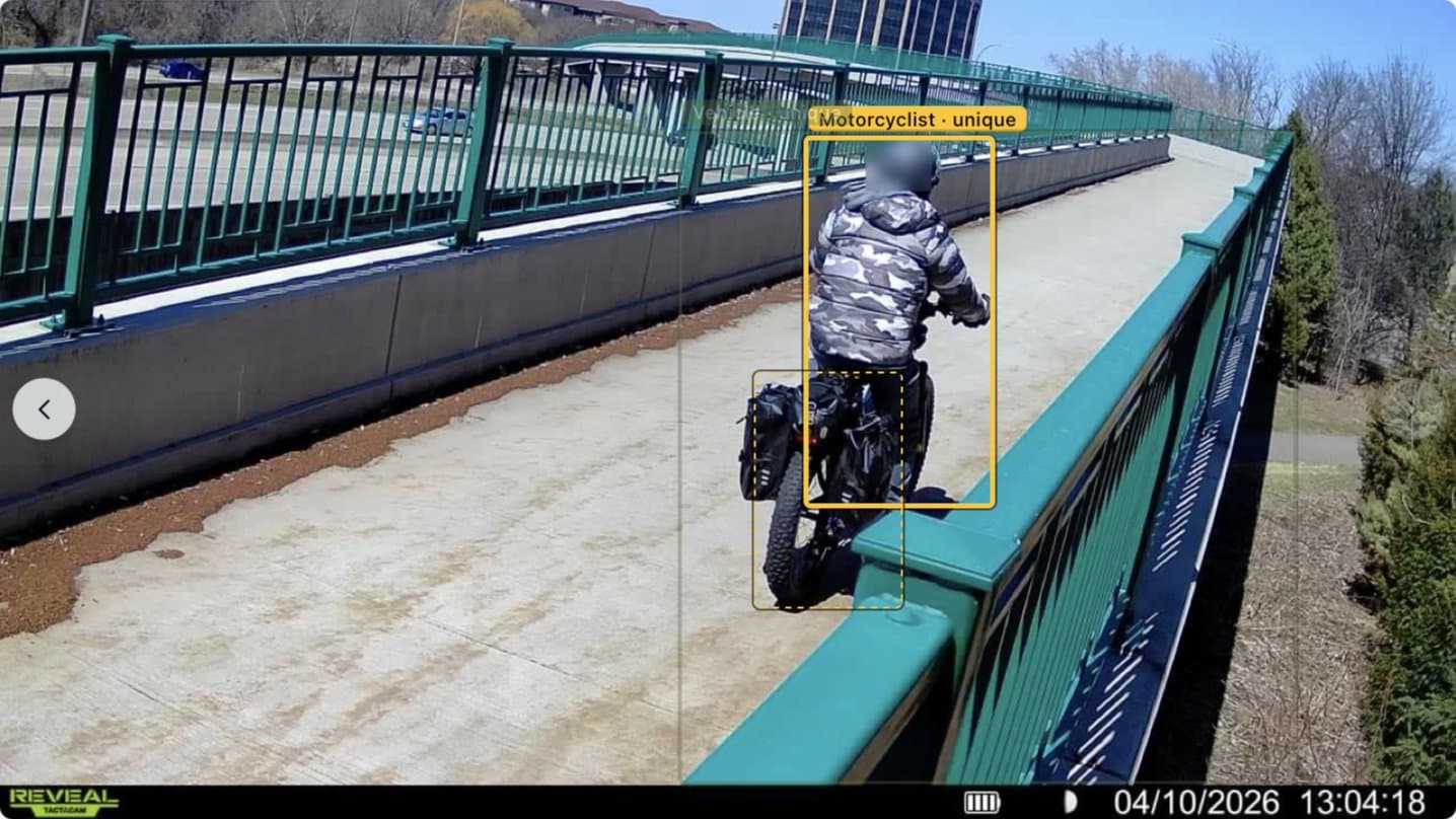
The trail is for people walking and riding bikes, but the cameras recorded e-bikes and larger motorized bikes crossing the bridge, including eight motorcycle passages at its east end on April 8 alone, some of them at dusk. Each one comes with a photo, so the agencies responsible can see exactly what is using the bridge and decide what to do about it.
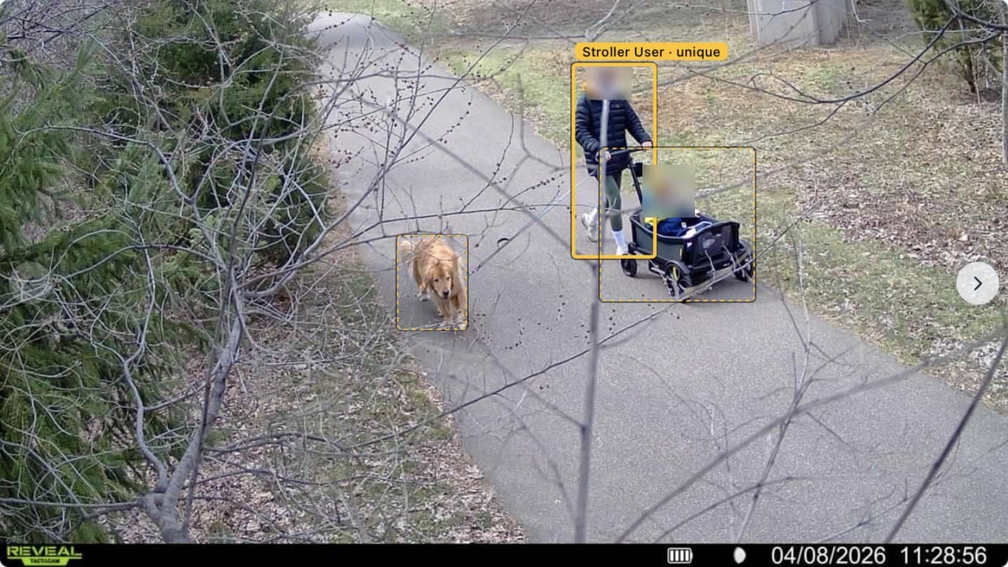
Strollers, wagons and kids
The same photos separate people pushing strollers and wagons from other walkers, and pair a person with the dog or bike they came with, so one family counts as one passage rather than a jumble of objects. That is the detail that tells a planner who a trail serves.
06 · What came next
A tool for studies the loaner counters can’t do
Comparable totals
Within 7–12% of an infrared counter on full days at a well-placed site, with a photo behind every count.
Context with the count
Mode, helmets, dogs, groups, direction and prohibited motorized use, all from the same images.
Nothing to build
Solar cellular cameras on trees and an existing post: no power, trenching or changes to the structure.
After the pilot, Waypoint and MnDOT kept working together on projects for Minnesota municipalities that need more than in-house counters can provide. The next step for the technology is a full three-way validation: cameras, infrared counters and manual counts at the same site.
07 · Lessons learned
What we learned
- 01
Placement is half the accuracy.
Two cameras 200 feet apart differed by 47% because one looked through a fence at highway traffic. Find a clear, angled view of the trail first.
- 02
Keep the road out of the trigger.
Every passing car started a 10-second cool-down. Aim cameras away from traffic, and use exclusions to keep it out of the counts.
- 03
Plan manual counts with days to spare.
Without a full manual count, a 7–12% gap between two counters can’t be assigned to either one.
- 04
The context is the finding.
Dog walkers avoiding the bridge and motorbikes using it were the most useful results, and neither shows up in a total.
Thanks to the Minnesota Department of Transportation for supporting this study through its counter loaner program.
08 · Sources
Sources
- Wikipedia, Nine Mile Creek Regional Trail
- Three Rivers Park District, Nine Mile Creek Regional Trail
- Three Rivers Park District, Nine Mile Creek Regional Trail grand opening is June 3 (May 2018)
- SEH, Nine Mile Creek Regional Trail (project portfolio)
- Metropolitan Council, 2014 Regional Solicitation application: Nine Mile Creek Regional Trail, West Segment
- MnDOT, Minnesota Pedestrian and Bicyclist Data Program
Pilot counts come from the Waypoint Analytics platform for the MnDOT Nine Mile Creek pilot, Apr 7 – 13, 2026, and the infrared comparison from Waypoint’s pilot report to MnDOT (April 15, 2026). Engineering notes are in the original deployment write-up.